Sammy Solo's Salute to the Maliseet TrailWelcome Page |
The Maliseet Trail Crossing of 2005:
Trip Report on the 2005 Crossing of the Ancient Maliseet
Trail
By Sammy Solo
Introduction
Planning for a 2005 crossing of the Ancient Maliseet Trail, from south of Woodstock NB to Old Town Maine, began in November 2004. The crossing was done over the nine-day period from May 20, to May 29 2005. We owe thanks for the valuable advice received from a number of people. Included among these are: Lane MacIntosh, who first captured our imagination with his own Maliseet Trail Tales based on his research in the 1980s, and from his own involved in the logistics for the 1994 crossing by Martin Paul & Ty Polchies; Nicholas N. Smith, who himself crossed the Trail in 1964 with Dr. Peter L. Paul, and proved a great supporter as we prepared; Bob Miller, who shared with us footage from his 1996 video reenactment of the 1994 crossing; John Heinstein who took the Trail from Benton as far as Eel River Lake in 2002; Tony Grant; Phillip Warn Foss; and Elbridge Cleaves. Even with assistance, 9 scouting trips were needed to find portage routes and make arrangements with private landowners along the Trail.
This was only the third attempt since the 1920s or 1930s to travel the full length of the Trail, and would be the first in that time to be done without the assistance of motor vehicles on the portage routes. Many of the carries were unmarked, unmapped, and unknown. The only existing maps of the Trail's portage routes known to us were sketches published by WF Ganong in 1899.
WF Ganong's Map No. 2 The Meductic - Eel River Portage. From a plan of 1827.
WF Ganong's Map No. 3 The Eel River -Chipnuticook Portage. From a plan of 1835 (by GF Playford).
WF Ganong's Map No. 5 The Portage from The Saint John to The Penobscot via the Baskahegan.
Francis Joseph Neptune, Chief of the Passamaquoddy Tribe - 1798 Map
The Members of the Crossing Party.
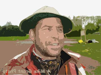
The members of the crossing were: Mike Grant of Fredericton NB; Matt Hopkinson of Hubbardston MA, USA; Beth Johnston of Fredericton NB; Dino KubiK of Fredericton NB; Craig Macdonald of Dwight ON; Nancy Macdonald of Fredericton NB; Paul Meyer of Fredericton NB; and last in alphabetical order only - Anthony Reader of St Stephen NB.
The Objective
The goal of the crossing was to experience the Ancient Maliseet Trail and to leave a digital record of what we would find so as to encourage future use of the Trail.
We agreed that we would set aside 9 days to do the crossing and our intent was to go all the way to Old Town ME but making it to the Penobscot River as an acceptable achievement.
No cars were used once we started and we tried to use the actual portage routes where possible. Three of the canoes were moved over the 15-17 kilometers of portage routes using "portage carts" while the canoe and packs of Paul Meyer and Beth Johnston were carried in the traditional manner. This allowed Beth and Paul to stay closest to what we considered the original portage trails.
Day 0: Evening of Friday, May 20, 2005
Camping in Hay Settlement, NB
The crossing party gathered at the Provincial hiking trail called the Maliseet Trail on Route 165 (Old TCH) just south of Woodstock NB. From here, we hiked in a short distance and camped for the evening.
PIC - Unloading at the Eastern Trail Head
PIC - Supper at the Trail Head
Day 1: Saturday, May 21, 2005
The Benton Portage and on to Molly's Rock on the Eel River.
Distance: Portage 5-7 kms Paddle 5kms
We walked west to the Saint John River to get a start as close to the site of Ancient Fort Meductic as the now-flooded Meductic flats would allow. At 9:30 am, after a group photo, we turned west to retract our steps to the previous night's camp and then onto Benton and the Eel River. Before departing the encampment, we left a Cuban Cohiba cigar. This act would be repeated until the Cohibas were gone.
We walked the hiking trail until it crossed under the new Trans Canada Highway and faded out. When the footpath disappeared, we followed a compass bearing trail towards Benton. Sometime after 2:00pm we exited the woods, walked the last 2-3 kilometers on the road and arrived at the Eel River around 3pm. We gathered our boats, gear, and departed from the Ducks Unlimited dam in Benton by sometime after 3:30pm to start our 24 km paddle up the Eel River.
Molly's Rock came into view around 4:30pm and went ashore for the night. The site offered limited space for camping but it was early in the season so there was enough standing dead wood to supply a fire.
PIC - Hays Falls On the Benton Portage
Day 2: Sunday, May 22, 2005
Molly's Rock to a point above Stafford's Mills.
Paddle 10 kms (estimated)
We were quickly on the water about 8 am and just as quickly the lead boats found themselves in a dead-end bog and unable to discern the channel. Flood conditions made the Eel's appearance confusing.
The River narrowed, the current gathered strength and our first set of rapids were at a short pinch in the River where eddies near the shore eased our passing up River. The next serious challenge was at Slater's Rips where concerted efforts were requited to move boats through a distinct transition zone under the bridge. Boats began poling and lining to deal with the challenges and we continuing on towards Stafford Mills through a number of rips.
We arrived at the Stafford's Mills Bridge a little after 1 pm and portaged around the next section of the River as the topo indicated an end to the rips within a kilometre. At 5:30 pm we made camp a short distance above Stafford's Mills.
PIC - Traditional Portaging Up The Eel
PIC - Portage Via Cart Up The Eel
Day 3: Monday, May 23, 2005
Above Stafford's Mills on the Eel to North Lake.
Portage: 6-7 kms & Paddle 12 kms
After breakfast, Craig cut a 100 metre portage to advance the boats and gear.
From this put in it was again necessary to pole the boats. We would encounter
three sections requiring poling before arriving at the remains of the earthen
dam at Watson's Mill and two sections after Watson's.
Big swampy dead waters marked the end of the difficulties ascending the 24 kilometres of the Eel River. We entered the widening sections of the River with a stiffening North East wind at our backs.
We arrived at Bear Trap Point a little after noon and stopped for lunch before entering First Eel River Lake. The Lake would require a 4 kilometre crossing with wind that had increased to the point of being a safety consideration.
The Lake crossing began a little after 1pm, and with a stop for water from a local well we arrived at the other end of the Lake around 2:30 pm. We took the occasion to check out some new information on the ancient portage trail and were on or way to North Lake by 3:30. We arrived at our North Lake camping site by 6pm.
Pic Camping on the Upper Eel River
Pic Portage from Eel River Lake to North Lake
Day 4: Tuesday, May 24, 2005
North Lake to Cleave's Landing on the Baskaheagan Stream.
Portage 5-7 Kms Paddle 25 kms
A strong North East wind continued as we crossed south over 5 kilometres of a choppy North Lake to arrive at the Canada Custom's Landing by 10:30. A visit to US immigration and then it was 1 km down the Thoroughfare and south onto 20 kilometres of a white capped and choppy Grand Lake.
We arrived at Davenport Cove by 4:30pm with stops at Spruce Point and Norway Point. Three of the boats were loaded on carts and Paul and Beth started the traditional crossing to Cleaves Landing a little after 5pm. The cart pullers deviated from the Baskaheagan Trail to arrive at Cleaves Landing on the Baskaheagan by 7:30 pm. Paul and Beth followed the original Baskaheagan Trail in the traditional way to arrive at Cleaves Landing at 8:30pm.
Pic Worked Stone at Spruce Point
Pic Camping at North Lake (Morning)
Pic Portaging The Baskahegan Trail
Pic Camping at Cleaves Landing
Day 5: Wednesday, May 25, 2005
Cleaves Landing on Baskaheagan Stream to Mattawamkeag River.
Paddle 25-35 kms Portage 1-2 kms (plus groceries)
That morning, Matt, Mike, and Craig took a canoe on a cart and walked the 3 miles into Danforth to do some grocery shopping. It took the boys and hour to walk a cart into town and, once the shopping was done, the paddle home on the Baskaheagan was only 30 minutes.
By 11:30 the shopping was done and we started on the Baskaheagan by 11:30am. We arrived at Bean Falls around 2pm, portaged around Bean Falls, and were back on the Baskaheagan by 3:30pm. Soon we were on the Mattawamkeag River and by 5pm we were in camp.
Pic On the Baskahegan Leaving Cleaves Landing
Pic Bean Falls On the Baskahegan
Pic Camping on the Mattawamkeag
Day 6: Thursday, May 26, 2005
Mattawamkeag River below Baskaheagan to Mattawamkeag Wilderness Park.
Paddle 25-30 kms
The rains were constant and the temperatures were the coolest of the trip. The paddle through the dead water below Wytopitlock was particularly cold and wet but that continuing North East wind balanced the weather out to be a net gain. The Mattawamkeag Wilderness Park came into sight around 4pm and was repreve with its Adirondack shelters, stacked firewood, and absence of other campers.
Pic Paddling in the Rain on the Mattawamkeag
Pic Arrival at the Mattawamkeag Wilderness Park
Day 7: Friday, May 27, 2005
Mattawamkeag Wilderness Park to Penobscot River North Lincoln.
Paddle 30 kms Portage 2-3kms
We ran the canoes through a short section of
the white water leading into the Park then around 10:30 the portage to Lower
Gordon started. Three canoes were again put on portage carts and tracked over
the Park's roads to Lower Gordon while Paul and Beth paddled out of camp towards
a real-deal portage journey along the trail following the River. All four
boats arrived at the top of Lower Gordon Falls about 11:30am.
We reached the Penobscot River early in the afternoon and made our encampment
above Lincoln around 6 pm. We had covered 16 kilometres on the Penobscot and
another 14 on the Mattawamkeag.
Pic Rapids in Mattawamkeag Wilderness Park
Day 8: Saturday, May 28, 2005
Penobscot River: North Lincoln to below Passadumkeag River
Paddle 40 kms Portage 1kms
We were up and on the River by 9am then stopped
to refill our water supply at Lincoln since we stopped drinking treated River
Water after North Lake. We paddle all day in misty to rainy conditions making
it eighth straight day of paddling in rain gear.
At Howland we portaged around the hydro dam at River-right and were back on
the River by 2:30.The weather began to clear and about 5 pm we camped 20 to
25 kilometres above Old Town. This was to be the first encampment where we
would enjoy a visible sunset in nine nights.
Day 9: Sunday, May 29, 2005
Penobscot River: Below Passadumkeag River to Old Town.
Paddle 25 kms
This day dawned on a changed weather system and the last breakfast of the crossing was under a sunny sky. We hit the River a little before 9am as grey clouds sweep across the southern sky. We made a number of stops and rafted together in the sunny conditions. As the morning progressed, the rain returned.
When we arrived at Indian Island, we passed on the western channel around the Island to which has a public landing before the hydro dam near Old Town.. Shortly before noon, Matt and Tony were the first of our party to arrive at Old Town landing and were ready with the cameras to capture the landing of the remaining three boats. There were no shortage of smiles as we posed for pictures to mark the conclusion of a crossing without incident, argument, or accident.
We walked to the Old Town Canoe Factory to wait for our shuttle home. There we looked at the canoes and watched a great video on the history of the company. Our shuttle driver, Tom Somerville, arrived at 5 pm and when we returned to the landing we had a chance to met Timothy Gould, a warden of the Penobscot Nation.
Pic Departure on the Last Leg To Old Town
Pic Lunch on the Last Leg To Old Town
So ended the 2005 Crossing of the Ancient Maliseet Trail.
Yours in the matters of the Maliseet Trail,
PS Check Out Anthony Reader's Account of the Crossing
Sammy Solo
June, 2005